Half Dome hike, June 30, 2014 |
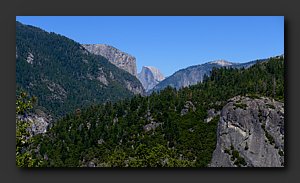
Half Dome seen from the western approach to the valley |
Trailhead to top of Vernal Falls. 6:06am, first light |
Trailhead to top of Vernal Falls |
Trailhead to top of Vernal Falls. First view of Vernal Falls. |
Trailhead to top of Vernal Falls |
Trailhead to top of Vernal Falls. Roger ascending steep steps to top of falls. |
Trailhead to top of Vernal Falls |
Trailhead to top of Vernal Falls |
Trailhead to top of Vernal Falls |
Trailhead to top of Vernal Falls. Sunlight in the distance. |
Trailhead to top of Vernal Falls |
Trailhead to top of Vernal Falls |
Vernal Falls to top of Nevada Falls |
Vernal Falls to top of Nevada Falls |
Vernal Falls to top of Nevada Falls. Looking back at Vernal Falls. |
Vernal Falls to top of Nevada Falls. First view of Nevada Falls. |
Vernal Falls to top of Nevada Falls |
Vernal Falls to top of Nevada Falls. Sunshine at last! (7:21am) |
Vernal Falls to top of Nevada Falls |
Vernal Falls to top of Nevada Falls. Level with the falls. |
Vernal Falls to top of Nevada Falls |
Vernal Falls to top of Nevada Falls |
Vernal Falls to top of Nevada Falls |
Vernal Falls to top of Nevada Falls |
Vernal Falls to top of Nevada Falls |
Vernal Falls to top of Nevada Falls |
Vernal Falls to top of Nevada Falls |
Nevada Falls to base of sub-dome - Roger |
Nevada Falls to base of sub-dome. Only 2 miles! The longest 2 miles in history ... |
Nevada Falls to base of sub-dome. First view of Half Dome from trail. |
Nevada Falls to base of sub-dome |
Nevada Falls to base of sub-dome |
Nevada Falls to base of sub-dome - Roger |
Nevada Falls to base of sub-dome - Roger |
Nevada Falls to base of sub-dome |
Nevada Falls to base of sub-dome - Chris |
Nevada Falls to base of sub-dome - Chris |
Nevada Falls to base of sub-dome - Chris |
Nevada Falls to base of sub-dome |
Nevada Falls to base of sub-dome |
Nevada Falls to base of sub-dome. We are not alone! |
Nevada Falls to base of sub-dome - Roger |
Nevada Falls to base of sub-dome - Roger |
Nevada Falls to base of sub-dome - Roger |
Sub-Dome to base of cables |
Sub-Dome to base of cables - Roger, Mattie, Kelly |
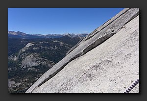
Sub-Dome to base of cables - Mattie, Kelly. Steep! |
Sub-Dome to base of cables - Roger, Mattie, Kelly |
Sub-Dome to base of cables - Roger, Mattie, Kelly |
Sub-Dome to base of cables. Don't look down! |
Sub-Dome to base of cables |
Sub-Dome to base of cables |
Sub-Dome to base of cables - Mattie |
Sub-Dome to base of cables |
Sub-Dome to base of cables |
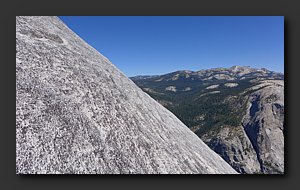
Sub-Dome to base of cables - Mattie, Roger approaching the top of the sub-dome. Top of Half Dome in the distance. |
Sub-Dome to base of cables - first view of the final ascent |
Sub-Dome to base of cables. People visible on the cables! |
Sub-Dome to base of cables - Mattie, Kelly, Roger. No more steps - just scramble on the granite. |
Sub-Dome to base of cables - Mattie, Kelly, Roger |
Sub-Dome to base of cables - Mary |
Sub-Dome to base of cables |
Cables to top |
Cables to top. Are we really going to be doing that?! |
Cables to top |
Cables to top |
Cables to top. Final resting place before the ascent. |
Cables to top |
Cables to top - Mattie, Kelly, Roger |
Cables to top - Kelly, Mattie, Roger |
Cables to top - Chris |
Cables to top - Chris |
Cables to top |
Cables to top - Mary |
Cables to top |
Cables to top - serious slope! |
Cables to top - serious slope! |
At the top! Mary, Kelly, Mattie |
At the top! Mary, Kelly, Mattie |
At the top! Roger |
At the top! Chris |
At the top! Chris |
At the top! Mary, Kelly, Roger |
At the top! Chris |
At the top! Chris |
At the top! Chris |
Heading back down - Chris |
Heading back down - Chris, Roger |
Heading back down - Mattie, Roger |
Heading back down |
Heading back down - Kelly, Roger |
Heading back down - Kelly, Roger. Very steep, nothing to hold onto ... |
Heading back down - Kelly, Roger |
Heading back down - cool river. |
Heading back down |
Heading back down |
Heading back down |
Heading back down |
Heading back down |
Heading back down. Top of Nevada Falls |
Heading back down. Nevada Falls. |
Heading back down. Nevada Falls. |
Heading back down |
Heading back down - Kelly, Mattie |
Heading back down. Back at the start, 4:58pm |
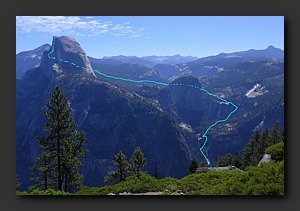
Perspective from Glacier Point. Trail map: http://www.yosemitehikes.com/yosemite-valley/half-dome/half-dome-trail-map.htm |


